Finding a reliable USB GPS receiver that works seamlessly with a PC, laptop, or embedded project can be challenging. The following handpicked models offer multi-GNSS support, plug-and-play compatibility, and robust performance across Windows, Linux, and more. Use this guide to compare options, evaluate timing and mapping capabilities, and choose a USB GPS adapter that fits your setup—from desktop navigation to Raspberry Pi projects and marine reliability.
Summary of Selected Products
| Product | Brand | Key Features | Platform Notes |
|---|---|---|---|
| VFAN USB GPS Receiver Antenna Gmouse | VFAN | UBX-G7020KT; GPS/GLONASS/QZSS/SBAS; 56-channel; U-Center compatible; OpenCPN/Kali Linux support | Windows 7-11; includes USB-C adapter |
| GlobalSat BU-353N USB GPS Receiver | GlobalSat | 75-channel All-In-View; built-in roof magnet; Android compatible with app | Windows/Linux; Android app optional |
| VK-162 G-Mouse USB GPS Dongle | Stratux | Multi-platform; Stratux-ready; long 7 ft cable | Windows/Linux/Raspberry Pi/Google Earth |
| Stemedu VK172 GPS Module | Stemedu | GP/GLONASS; 172 module; testable via GPS protocol data | Windows/Android/Linux/Raspberry Pi |
| HiLetgo VK172 G-Mouse USB GPS Receiver | HiLetgo | VK172 G-MOUSE; GP/GLONASS; Windows support | Windows/Linux |
VFAN USB GPS Receiver Antenna Gmouse

The VFAN USB GPS Receiver features a built-in UBX-G7020KT multi-GNSS chip, delivering support for GPS, GLONASS, QZSS, and SBAS. This setup enables fast, accurate positioning and reliable network time synchronization via NTP. The device ships with official GNSS software U-Center for parsing standard NMEA and GNSS messages (GPGGA, GPGLL, GPGSA, GPGSV, GPRMC, GPVTG, GPZD). It is compatible with Windows operating systems from XP through Windows 11 and supports OpenCPN, Kali Linux, and Google Earth Pro. An adapter allows USB-C connectivity for broader device compatibility, including Android phones and tablets with GPS tools software.
Pros: Multi-GNSS for robust accuracy, free GNSS evaluation software, broad OS compatibility, and flexible data parsing with common GNSS sentences.
Cons: Some users may need to install support software and drivers; performance depends on antenna placement and environmental visibility of satellites.
GlobalSat BU-353N USB GPS Receiver

The GlobalSat BU-353N delivers 75-channel All-In-View tracking and a built-in magnet for easy rooftop mounting. It’s a compact USB module designed for desktop or vehicle use and is widely supported on Windows and Linux, with Android compatibility through apps. While it emphasizes road and marine navigation, its broad GNSS receiver capability makes it a solid choice for PC-based mapping and timing tasks. Users can leverage standard GNSS tools to interpret NMEA data and integrate with mapping software such as Google Earth or OpenCPN.
Pros: Strong all-in-view tracking, simple mounting, good Windows/Linux compatibility, and straightforward data output.
Cons: Android app requirement for mobile use varies by device; some users may prefer more modern USB-C options or additional data interfaces.
VK-162 G-Mouse USB GPS Dongle

The VK-162 G-Mouse USB GPS Dongle is designed for remote mounting and multi-platform use, including Stratux, Raspberry Pi, Google Earth, Windows, and Linux. It ships with a 7-foot cord for flexible placement and is known for plug-and-play readiness in Stratux-based builds. This model is favored by hobbyists and experimenters who need a compact, robust GPS data source for aviation projects, mapping, and timing synchronization across devices.
Pros: Wide compatibility, long tether for remote mounting, and strong community support through Stratux projects.
Cons: Some users report driver setup requirements on certain Linux distributions; not designed for Android/iOS, limiting mobile ease of use.
Onyehn VK-162 G-Mouse USB GPS Dongle
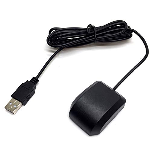
The Onyehn VK-162 G-Mouse is a compact USB GPS solution offering Windows and Linux support, but it is not compatible with Android or iOS. It emphasizes ease of use for travelers who want accurate positioning worldwide after downloading country maps. This device can be valuable for timing data and navigation in laptops or embedded systems where GNSS timing is essential for synchronization and data logging.
Pros: Broad OS support for desktop ecosystems; world-wide positioning without service fees; simple plug-and-play approach for PC projects.
Cons: Not suitable for mobile ecosystems; some features may require GPS tools apps to extract data on certain platforms.
VK-162 G-Mouse USB GPS Dongle (Geekstory)
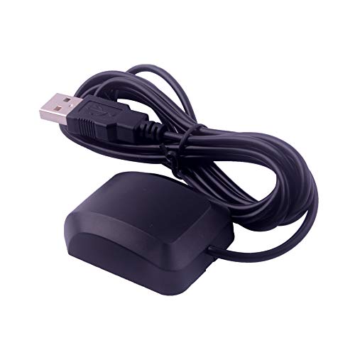
The Geekstory VK-162 variant is designed for Windows XP/7/10/11 and Linux environments and emphasizes driver installation prior to use. It features a long 190 cm cable and a magnetized antenna for outdoor GPS signal acquisition, which improves reception in areas with limited sky exposure. While not truly plug-and-play on all devices, it supports a wide range of desktop and embedded setups and is popular among hobbyists seeking versatile GPS data integration.
Pros: Long cable for flexible placement; strong GNSS support on multiple platforms; magnetized antenna for outdoor signal acquisition.
Cons: Requires driver installation on many systems; not ideal for immediate “just works” scenarios without compatibility checks.
Mgears USB GPS Receiver
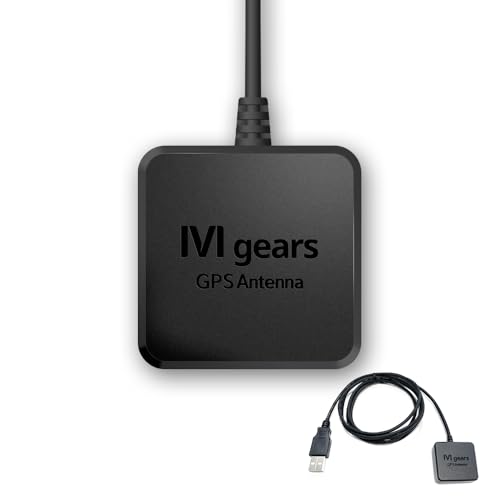
The Mgears USB GPS Receiver targets navigation across laptops, PCs, and marine setups, offering GPS and GLONASS support with a 72-channel GNSS receiver and a WAAS/EGNOS/MSAS-enabled SBAS hybrid engine. It supports NMEA-0183 and binary protocols, compatible with U-blox 8 standards. The product emphasizes easy dashboard integration for vehicle navigation, with a compact body and a long 1.5 m cable. This makes it suitable for in-car setups, home desktop mapping, or DIY navigation rigs where robust GNSS coverage is essential.
Pros: Comprehensive GNSS support; multiple protocol compatibility; long cable for flexible installation.
Cons: As with some USB GPS dongles, driver installation and configuration may be required on certain systems; performance may depend on environmental visibility to satellites.
Buying Guide: Key Considerations For Choosing A USB GPS Receiver
- Platform compatibility: Ensure the receiver supports your operating system (Windows, Linux, macOS, or Raspberry Pi). Some models are not plug-and-play on all systems and may require drivers.
- GNSS coverage: Look for multi-constellation support (GPS, GLONASS, QZSS, SBAS). More satellites in view improve positioning accuracy and time synchronization.
- Antenna and mounting: External antennas, magnet bases, and remote mounting help improve signal in urban canyons or indoors. Cable length matters for flexible placement.
- Data output options: NMEA-0183 is common, but some devices offer binary protocols for higher performance. Check compatibility with your software (OpenCPN, Google Earth, or custom logging).
- Software ecosystem: Free GNSS tools like U-Center can simplify data parsing. Evaluate driver availability and community support for your chosen platform.
- Use case alignment: Desktop navigation, timing accuracy, or embedded projects (Raspberry Pi) may dictate whether you prioritize ease of use or customization.
- Reliability vs. ease-of-use: Some devices are “plug-and-play” on Windows, while others excel in Linux environments but require configuration. Balance convenience with your technical comfort.
- Power and connectivity: USB power draw, USB-C compatibility, and supply cables can affect compatibility with laptops and tablets.
Overview: If the goal is reliable PC-based GPS with broad software support, consider devices with established Windows and Linux compatibility, robust GNSS support (GPS/GLONASS/QZSS/SBAS), and a strong data interface like NMEA. For embedded projects, prioritize longer cables, open data formats, and community-driven ecosystems to enable quick integration with OpenCPN, Google Earth, or Raspberry Pi setups.